

Sign Up for Citizen-Alert – Jackson & Josephine County
Sign Up For Ashland’s Everbridge Citizen Alert System
QUICK MENU – Weather – Fire – Air Quality – Solar Storm

Oregon Trip Check – Highway 5 Twitter
Southern Oregon Road Cams
Roxy Ann Peak
Live Stream via Youtube
News Sources

Weather
Latest Lightning Strikes on Google Maps – iWeatherNet

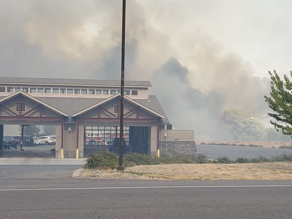
Fire
| Fire and Smoke Map | Area Fire Map | Interactive Fire Map |
- National Fire Information
- Current Fire Incident Information System
- NOAA’s Fire Weather Outlook
- MODIS Active Fire Mapping
- Interagency Wildland Fire Air Quality Response Program
- National Interagency Coordination Center
- National Interagency Fire Center
Current Fires – Regional map of fires
- National Fire Report — National Interagency Fire Center’s daily news update
- State of Oregon — Daily Fire Update from the Oregon Department of Forestry
- State of California — Fire news and update from CalFire
- State of Washington — Fire news from the Washington State Department of Natural Resources
Air Quality
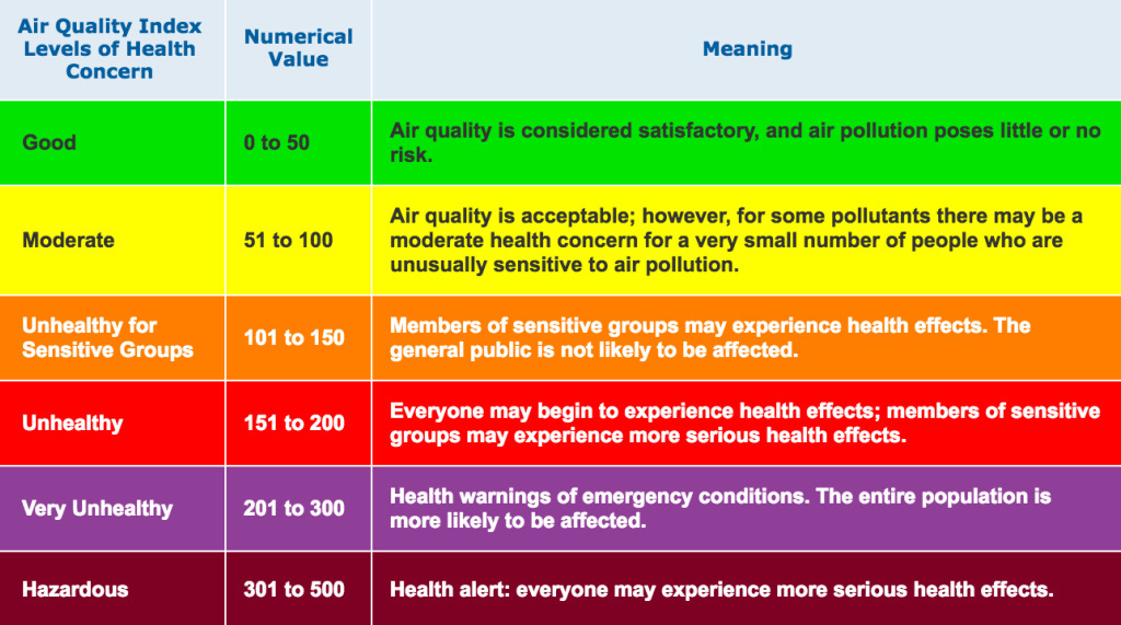
Blue Sky Daily Readings
Here is a smoke map showing sources and winds
Live Streams
Scanners
Jackson County, Oregon (OR) Scanner Frequencies and Radio Frequency Reference
Oregon GMRS | 2 Way Radio Repeaters in Southern Oregon
Why Do I Need a GMRS Radio License & How Do I Get It?
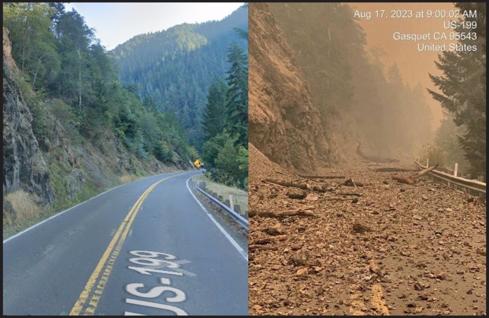
Travel Information and Resources
- Oregon Smoke Information – Smoke forecast for each day
- Oregon Smoke Information — Oregon smoke forecasts and air quality updates
- TripCheck — Current road conditions, closures and delays
- Travel Alerts — Wildfire and travel conditions updates provided by Travel Oregon
Solar Storms
NOAA Space Weather Predictions